What exactly is a map projection?
A map projection is a systematic method of representing Earth's curved, three-dimensional surface on a flat, two-dimensional map. This process always involves some form of distortion, as it is impossible to flatten a sphere without stretching or compressing parts of it. Projections are chosen based on the specific purpose of the map and the properties a cartographer wishes to preserve, such as area, shape, distance, or direction.
Why are map projections necessary?
Map projections are necessary because we often need to use flat maps for practical purposes like navigation, urban planning, or displaying data. Globes are excellent for true representation, but they are bulky and cannot be easily carried or printed. Projections allow us to create convenient flat maps, enabling us to measure, analyze, and communicate geographic information in a usable format.
What are the most common types of map projections?
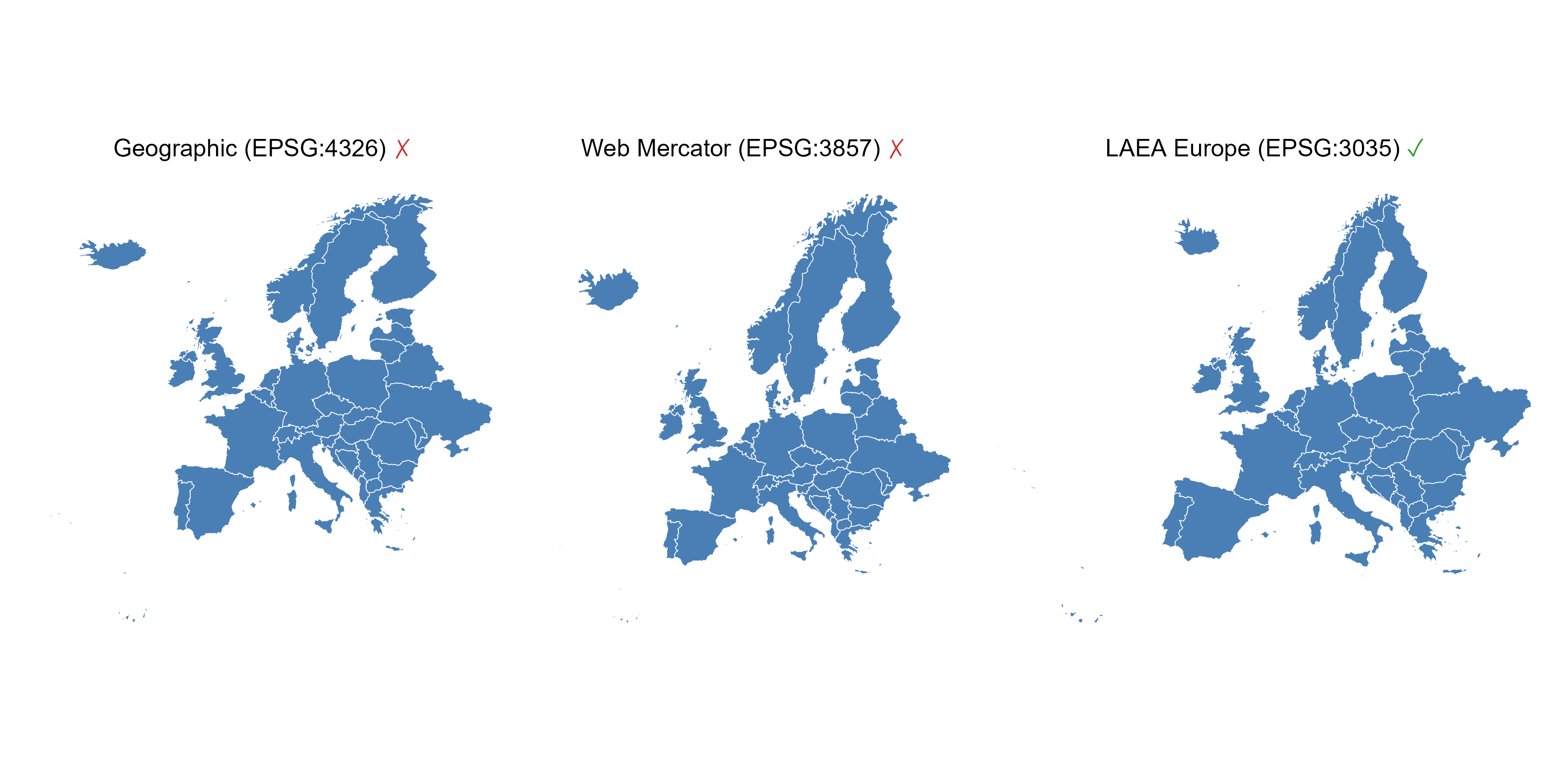
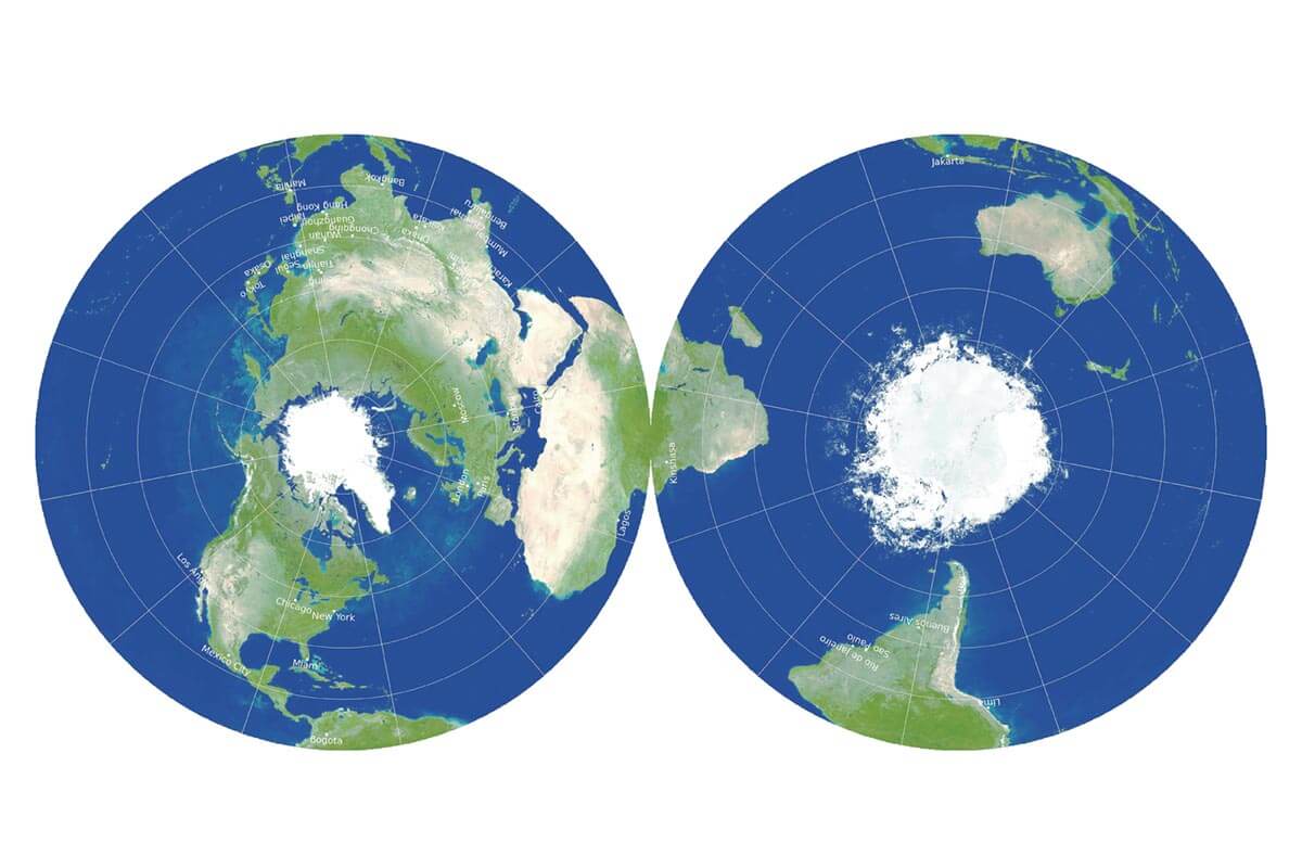
The most common types of map projections generally fall into three categories: cylindrical, conic, and azimuthal (or planar). Examples include the Mercator projection (cylindrical, good for navigation), Albers Equal Area Conic (conic, preserves area, often used for US maps), and Stereographic projection (azimuthal, preserves shape locally). Each type has distinct properties and specific applications.
How do map projections affect US map accuracy?
Map projections significantly affect US map accuracy by introducing distortion. For a country as large as the United States, no single projection can perfectly represent all its properties. Some projections might accurately show the shape of states but distort their relative size, while others might preserve areas but stretch shapes. This means understanding a map's projection is crucial for interpreting distances, areas, and directions correctly across the US.
Where can I find reliable information on map projections?
Reliable information on map projections can be found on specialized geographic information system (GIS) websites, university cartography departments, and dedicated online resources like the Map Projection Wiki. These sources offer detailed explanations, historical context, and practical examples of various projections, helping US users deepen their understanding of cartography without cost.
Are there specific projections best for local US areas?
For local US areas, projections that minimize distortion over smaller regions are often preferred. For instance, various State Plane Coordinate Systems (SPCS) use different conic or transverse Mercator projections specifically tailored to individual US states or counties, providing very high accuracy for local land surveying and detailed mapping projects. These are far more accurate locally than global projections.
How does distortion relate to map projections?
Distortion is an unavoidable consequence of all map projections. It refers to the inevitable alteration of shape, area, distance, or direction when transforming a spherical surface to a flat one. A projection can preserve one or two of these properties, but it cannot preserve all four simultaneously. Understanding distortion helps users critically evaluate maps and choose the best projection for their specific needs, especially when dealing with US geographical data.
Map Projection Wiki, what is map projection, best map projections US, how map distortion works, local map accuracy, GIS terms explained, practical map guides, Google Maps projectionMap Projection Wiki serves as an essential online resource for United States citizens seeking to understand how maps represent our planet. It clarifies what map projections are, why they matter for accurate navigation, and how different projections affect the appearance and measurement of geographical areas across the US. This comprehensive wiki explains where to find detailed information on various projection types, how to choose the right one for specific mapping tasks, and the impact of distortion on local-area maps. For local guides, knowing about projections helps interpret map data, contribute accurate information to platforms like Google Maps, and grasp the nuances of scale and distance. There are no costs or special requirements to access this valuable public knowledge base; it is readily available to enhance anyone's geographic literacy and improve their ability to use and create maps effectively within the US.
- What kind of information does Map Projection Wiki provide? - Map Projection Wiki offers detailed explanations of various map projections, including their history, mathematical basis, and practical applications. It covers distortion types, advantages, disadvantages, and common uses for different projections, making complex cartographic concepts understandable for a wide audience, especially in the US.
- Is Map Projection Wiki free to use for US residents? - Yes, Map Projection Wiki is completely free and accessible to everyone, including US residents. There are no subscription fees or special requirements to access its comprehensive content. It functions as a public knowledge base for all things related to map projections and their impact on geographic understanding.
- How can understanding projections help me with Google Maps? - Understanding projections helps you interpret Google Maps more accurately. Google Maps primarily uses a variant of the Mercator projection, which distorts area, especially at higher latitudes. Knowing this allows you to realize that landmasses near the poles appear larger than they are, improving your spatial awareness when navigating or comparing regions in the US or globally.
- What is the best map projection for the continental United States? - For the continental United States, common choices include the Albers Equal Area Conic and Lambert Conformal Conic projections. Albers preserves area, useful for statistical maps, while Lambert preserves shape locally and is often used for aeronautical charts and US state maps. The 'best' depends on the map's specific purpose.
- Can Map Projection Wiki help with GIS projects in the US? - Absolutely. Map Projection Wiki is an excellent resource for anyone involved in GIS projects in the US. It provides foundational knowledge on coordinate systems, datums, and projection parameters, which are critical for accurate data analysis, spatial modeling, and creating precise maps for various applications across the United States.
- How do I search for specific projections on the wiki? - To search for specific projections on Map Projection Wiki, simply use the search bar available on the website. You can type in the name of a projection, such as 'Mercator' or 'Transverse Mercator,' or broader terms like 'equal area projection' to find relevant articles and information quickly and efficiently.
- What are the main types of distortion explained on the wiki? - Map Projection Wiki explains that all projections introduce distortion in one or more properties: area, shape, distance, or direction. It details how different projections attempt to minimize distortion for specific properties while acknowledging that perfect representation of all properties on a flat map is impossible, providing crucial context for US map users.
What Is Map Projection Wiki?
Understanding the Basics of Map Projection
Map Projection Wiki offers a thorough, accessible guide to the methods used for representing Earth's curved surface on a flat map. It details how this process inevitably involves distortion, explaining the different properties preserved or sacrificed in various projections. For anyone in the United States interested in geography, mapping, or local planning, this wiki is a fundamental resource for grasping the science behind the maps we use daily.
Understanding map projections is more than just academic; it directly affects how we interpret distances, areas, and shapes on a map. The wiki breaks down complex concepts into understandable segments, making it easier for a general audience to learn about azimuthal, conic, and cylindrical projections, among others. Each entry provides clear examples and explanations, ensuring you can quickly grasp the core ideas.
This online knowledge base is maintained by experts and enthusiasts, ensuring the information remains accurate and current. It serves as a central point for definitions, historical context, and practical applications of map projections, providing a reliable source for students, professionals, and curious citizens alike to deepen their understanding of cartography.
Why US Local Guides Need Map Projection Knowledge
For US local guides and mapping enthusiasts, a solid understanding of map projections is incredibly valuable. It directly impacts how you view and contribute to platforms like Google Maps, helping you understand why certain areas might look stretched or compressed depending on the projection used by the service. This knowledge allows for more accurate reporting and a better appreciation of the challenges in digital mapping.
When you are documenting local businesses, points of interest, or hiking trails, knowing about projections helps you appreciate the potential for slight inaccuracies in measurement or representation. The wiki explains how different projections preserve specific properties such as area, shape, distance, or direction. For example, understanding an equal-area projection helps if you are calculating land sizes for conservation efforts in a US national park.
Furthermore, recognizing the underlying projection of a map can influence how you give directions or describe locations. A local guide who understands that a specific map might distort distances near the poles, but preserves angles locally, can offer more precise guidance to others. The Map Projection Wiki empowers US users to become more informed contributors to our collective geographic understanding.
How to Use Map Projection Wiki for Practical Insights
Navigating the Wiki Content Effectively
To get the most out of Map Projection Wiki, start by using its search function to find specific projection names or concepts you are curious about, such as Mercator projection or transverse Mercator. The wiki is organized with clear categories and internal links, allowing you to easily jump between related topics. Think of it as a comprehensive digital textbook where you can find definitions, examples, and the mathematical basis for various projections.
Explore the 'Types of Projections' section to compare the characteristics and common uses of different mapping methods. For instance, if you are planning a road trip across the continental US, you might want to understand conic projections which are often used for mid-latitude regions. The wiki provides detailed explanations for each type, including their strengths and weaknesses concerning distortion.
Do not hesitate to click on internal links to delve deeper into related terms like 'datum' or 'coordinate systems.' These interconnected topics are crucial for a holistic understanding of how maps work. The wiki is designed for self-guided learning, so take your time exploring the articles that directly address your mapping questions or curiosities.
Applying Knowledge to Real-World Mapping Scenarios
The information on Map Projection Wiki is not just theoretical; it has direct real-world applications for US citizens. If you are using a GPS device or a mapping app, understanding the underlying projection helps you interpret the displayed map more accurately. For example, knowing that Google Maps primarily uses a Mercator projection helps you understand why Greenland appears disproportionately large compared to its actual size.
For local planners, real estate agents, or anyone involved in land management within the US, choosing the correct map projection for a specific project is critical. The wiki provides guidance on which projections minimize distortion for certain geographical areas or specific purposes, such as maintaining accurate area measurements for property boundaries or preserving angles for navigation. This practical knowledge can save time and prevent misinterpretations.
Even for everyday users, applying this knowledge means you can critically evaluate maps you encounter in news articles, textbooks, or online. You will recognize that no flat map is perfect, and each has a specific purpose and inherent distortions. This awareness allows you to make more informed decisions when comparing geographic information and understanding spatial relationships across the United States.
Map Projection Wiki explained, types of map projections, how to choose a projection, understanding map distortion, local US map accuracy, GIS map resources, practical mapping insights


Printable Map Projections PROJ Projection Wikipedia 300PX Kavraiskiy VII SW Top Maps That Ultimately Explain Geoawesome U1 Which Is The Best Goode Homolosine What Are Metsker 1200077.


Correcting The Map Reshaping Perceptions Of Africa Projections Projection Earth AIRY2H These Tools Will Let You Master Geoawesome Net Comparison A Guide To Geography Realm Mercator World Caitlin Dempsey Facts About 1744765466.


List Of Map Projections Calm Projection World And Year 2026 The With 1000 F 1754974276 PDF In Wikipedia How Work GIS Geography Miller Cylindrical Wikiwand.


List Of Map Projections Wikipedia 300PX Cassini Projection SW USGS Albers Conic Tall Printable World A Guide To Geography Realm Robinson 2026 Stylized Video Overlaid With 1000 F 1755037871.


Projection In 2026 Of The Most Powerful Economies World R 2026 V0 2026 QBAM Resource Map February 2026 By On Deviantart 2026 DFGR2SO Pre Projections A Practical Guide To Common Mistakes And How Fix Featured Thousand Globe Royalty Free Images Stock Photos Crystal 2026 260NW 2648370739 Global Showcasing Regions With Number Tiles Year 418812709.


Projection Cartography On NEG90 What The Predict For Major Events In 2026 20251115 WOT900 Wikipedia Grey Green Projections Maps Generator V0 World Economic Outlook April 2026 Global Economy Shadow Of War Weo 2026 Map File Wiki Language Editions Created 2026 Svg Wikimedia Commons 960PX 2026.

Types Of Map Projections World Projection Title To Geospatial Data Analytics Global Warming Earth Climate De Wikipedia 960PX Usgs Albers Equal Area Conic.